Google Maps sorts out its transport
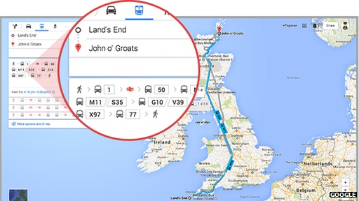
Google has added public transport information for the whole of the UK to its Maps app. Included now are departure times and routes for buses, ferries, trains and trams in England, Scotland and Wales.
Google says it can now plan a journey from coast to coast of the UK.
This means it can also make the information available to other app creators via its Maps application programming interface. This is provided free of charge to services with relatively low traffic but at a cost to others.
“Third-party developers will be able to take advantage of this and basically mash up [their services] with the API,” Mr Tattersall said.
He added that Google would also use the data to enhance its own anticipatory search service, which suggests information before a user asks for it.
“If you’re in Sheffield but live somewhere else, around home time Google Now will use this transit data to suggest some ways back,” he gave as an example.
For the moment, such results are based on preset timetables rather than live transport information, with the exception of London where real-time data is used.
But Mr Tattersall said that his team was keen to make the wider transit service more reactive in the future.


